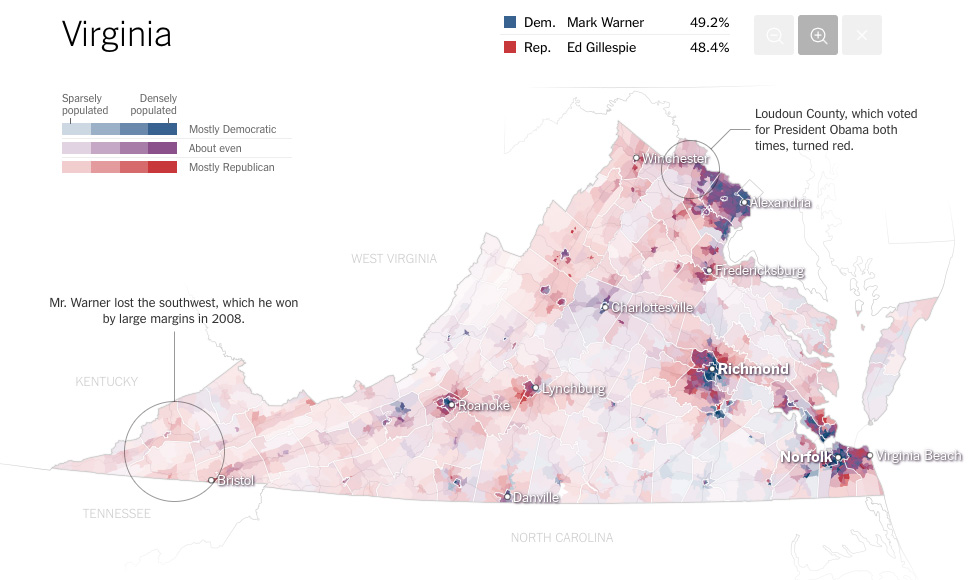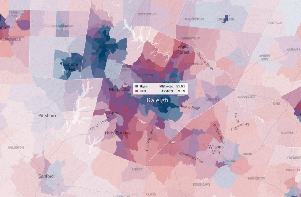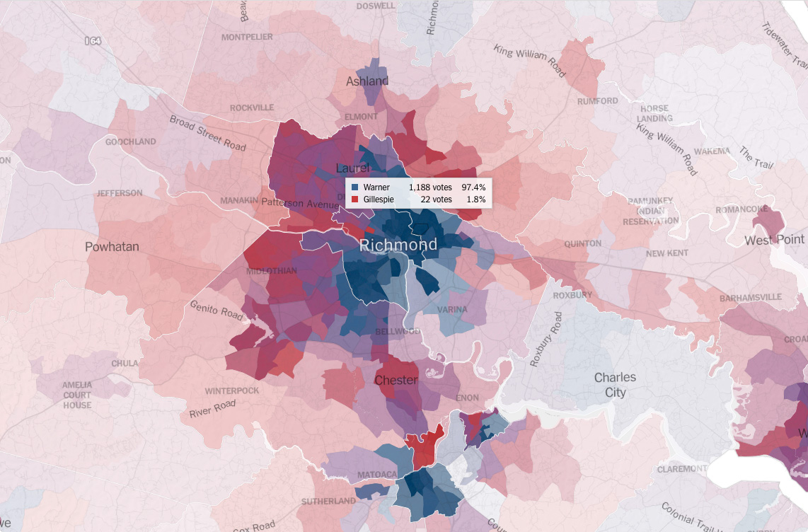
I came across this Interactive feature in The Upshot NYT section showing voting results from the recent US Senate Mid Term Elections.
The Maps are by Amanda Cox, Mike Bostock, Derek Watkins, and Shan CarterNov using various data sources, including the State Board of Election data, Public Access Projects and OpenStreetMap.